Enjoy Murray River trails but take care in flood-affected areas
Published on 31 March 2017
With the traditionally busy Easter holiday period rapidly approaching, residents are reminded to take extra care when using unsealed roads and tracks along the Murray River following last year’s flooding event.
The Easter period normally sees a significant increase in people camping and using popular roads and tracks along the riverfront, many of which were inundated due to minor flooding of the Murray River late last year.
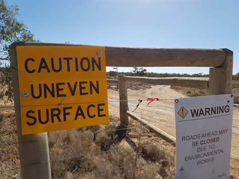
Despite river levels receding to normal, there are still some roads, tracks, car parks and shared paths along the river that need to be rectified, particularly between Merbein Common and Nangiloc/Colignan.
Mildura Rural City Councillor for Infrastructure and Transport Greg Brown said that while most areas are accessible for two-wheel-drive vehicles, some tracks along the riverfront remain difficult to negotiate, or in some cases may be suited to four-wheel-drive vehicles only.
“Drivers are urged to be mindful that some of the areas they’re used to visiting may be difficult to access and to plan ahead if intending to use these areas during the Easter holiday period,” Cr Brown said.
“Alternatively, if you know of visitors travelling to Mildura for Easter who intend to enjoy these areas, just check to ensure they’re still accessible.”
Bike paths and walking tracks along the riverfront between Apex Park and the Merbein boat ramp may also be affected due to the flooding.
Council is currently sourcing funding to complete these rectification works.
Parks Victoria roads and tracks in the popular Kings Billabong and Bruces Bend areas have been rectified and are fully accessible, as is Psyche Pumps Road, which was graded last month.
Parks Victoria advises that Psyche Pumps Road is currently in good condition and, barring exceptionally wet weather, provides good access to camping areas in the park.
One area that remains inaccessible due to extensive damage caused by the recent Murray River flooding is the entrance to the Karadoc Sandbar via Edey Road.
Parks Victoria is continuing to work through the insurance claim process in a bid to rectify this and other areas damaged during the recent floods, however this entrance is not expected to be accessible by Easter, nor will the boat ramp at the Karadoc Sandbar.
The nearest formal boat ramp downstream is at Red Cliffs, while upstream, the closest is Danes Road.
Other areas of the district significantly impacted by December’s flooding included Rudds Road and Barko Road in the Iraak area.
Council has made significant progress to works on Rudds Road, which has now been reopened to two-way traffic, while the five-tonne vehicle weight limit previously imposed has been lifted.
However drivers are reminded there is a 40km/h speed limit on this section of Rudds Road until road shoulder reconstruction works have been completed.
Barko Road meanwhile remains closed to traffic due to the significant damage caused by the flooding, which washed away part of the road.
Council is currently co-ordinating with other agencies on designs and planning for reconstruction works, however this process is expected to take several months.
Media enquiries
Ben Piscioneri
p) (03) 5018 8689
e) ben.piscioneri@mildura.vic.gov.au